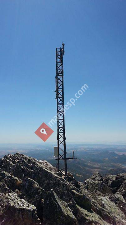
La Villuerca, also known as Risco de la Villuerca, Pico la Villuerca and Pico de las Villuercas is the highest peak of the Sierra de Villuercas range, also known as Sierra de Guadalupe.It is located 6 km west of Guadalupe town in Las Villuercas comarca, Cáceres Province, Extremadura, Spain and is the highest point of the greater Montes de Toledo system.DescriptionLa Villuerca has an elevation of 1,603 metres above sea level and is a conspicuous mountain that can be seen from quite a distance in the surrounding landscape. This peak has an ancient name that has been documented since 1353 and it gives its name to Las Villuercas comarca.There is a narrow paved road leading to the mountaintop where there are abandoned military installations of the former Base Centro Táctico, CT2,Guadalupe-Villuercas with tall antennas and a heliport. The peak is often covered with snow in the winter.
 Pico Villuercas
0 metros
El Risco de la Villuerca, también conocido como Pico de la Villuerca se encuentra cer...
Pico Villuercas
0 metros
El Risco de la Villuerca, también conocido como Pico de la Villuerca se encuentra cer...Agregue este mapa a su sitio web;

Utilizamos cookies y otras tecnologías de seguimiento para mejorar su experiencia de navegación en nuestro sitio web, mostrarle contenido personalizado y anuncios dirigidos, analizar el tráfico de nuestro sitio web y comprender de dónde provienen nuestros visitantes.. Política de privacidad